- Subscribe to RSS Feed
- Mark Topic as New
- Mark Topic as Read
- Float this Topic for Current User
- Bookmark
- Subscribe
- Mute
- Printer Friendly Page
How could LabVIEW read the latitude and longitiude of a position from google map
09-26-2014 08:50 AM
- Mark as New
- Bookmark
- Subscribe
- Mute
- Subscribe to RSS Feed
- Permalink
- Report to a Moderator
Hi,
i want to use labview to control a multirotor. But how could a position be read by labview from google map?
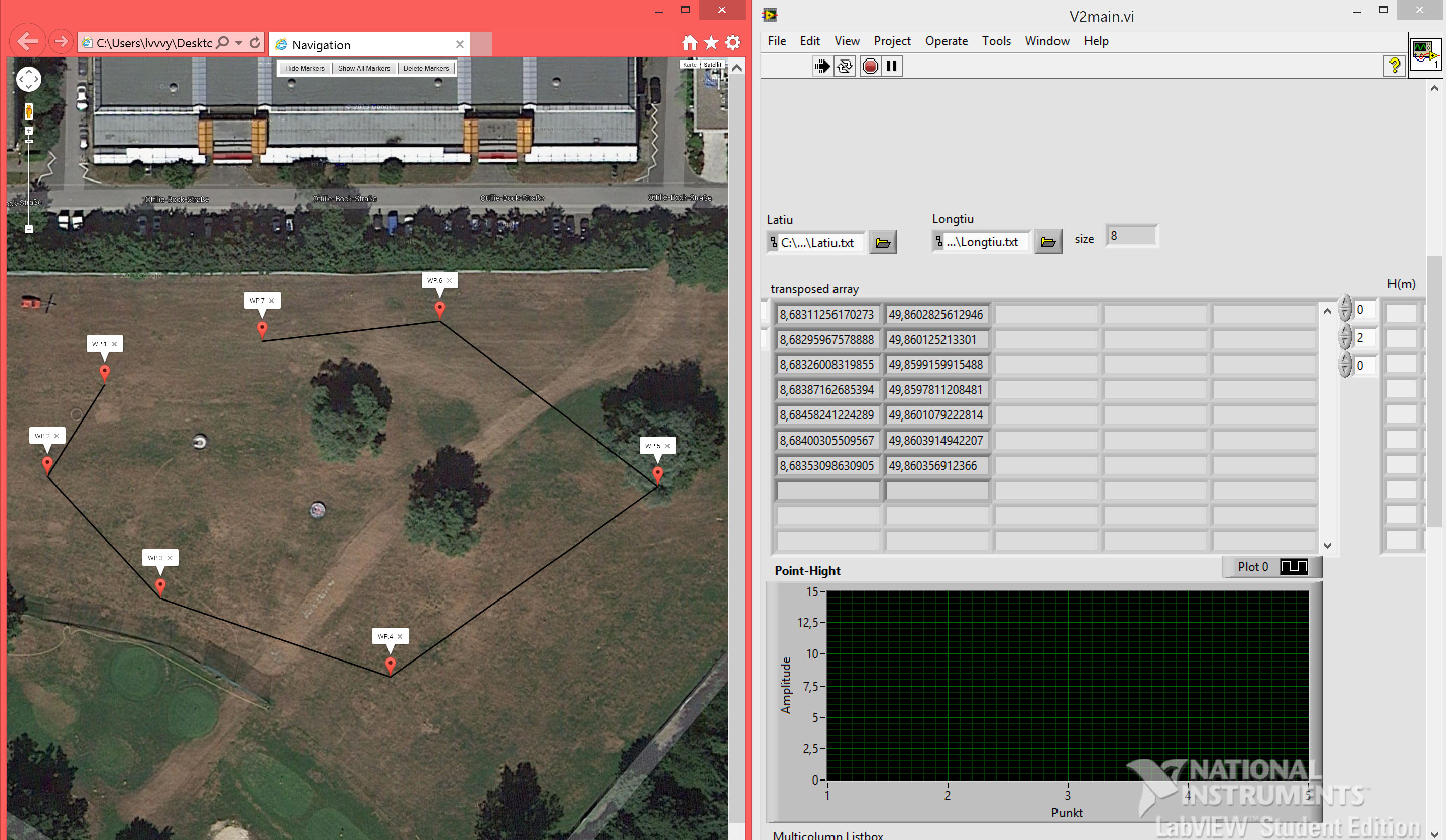
At moment i use javascript to creat a google map DOM. It could build two txt.file with latitude and longitude. Labview can read those txt.files and get the position(like the picture). But this map Dom can only be used in IE explorer, because i use ActiveXObject (JavaScript) to creat the txt. So it is possible, that this google map DOM direct be loaded by labview, like use ActiveX? Or some better way to read the Position from google map?
Thanks for any help.
09-26-2014 09:05 AM - edited 09-26-2014 09:05 AM
- Mark as New
- Bookmark
- Subscribe
- Mute
- Subscribe to RSS Feed
- Permalink
- Report to a Moderator
Your picture does not show.
09-26-2014 09:52 AM - edited 09-26-2014 09:54 AM
- Mark as New
- Bookmark
- Subscribe
- Mute
- Subscribe to RSS Feed
- Permalink
- Report to a Moderator
thanks for your reminding. this is the picture.
09-26-2014 07:10 PM
- Mark as New
- Bookmark
- Subscribe
- Mute
- Subscribe to RSS Feed
- Permalink
- Report to a Moderator
You can use .NET Nodes to interact with GMaps in LabVIEW, here there is a library that could be useful for you: http://greatmaps.codeplex.com/releases/view/20235
And a complete example: https://decibel.ni.com/content/docs/DOC-7983

